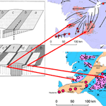
The opening of the North Atlantic Ocean between The Faroe Islands and Greenland ◊. 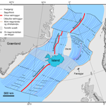 ◊
◊  started ≈ 53 Ma. ◊
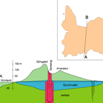
Now the Mid-Atlantic Ridge reaches above sea level at Saint Peter almost just at the equator circle, the Azores, Iceland and Jan Mayen. ◊. 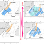 ◊.
◊.  ◊
◊ 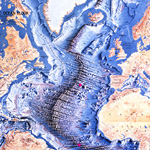
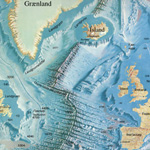
We can say that Iceland straddles the Mid Atlantic Ridge and we suppose that a hot spot ◊ 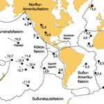 is lifting it high enough to reach above the sea level. ◊
 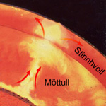 ◊
◊  ◊
◊ 
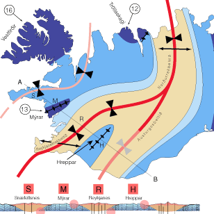
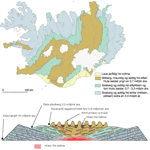
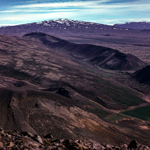
The American and Eoroupean Plates are drifting apart here in Iceland ◊ 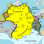 and along the Atlantic Ridge goes a rift valley which is to be seen in the south west and northern part at the active zone. ◊
 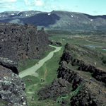 ◊
◊ 
The ridge has been propagating during the geological history of Iceland. ◊ 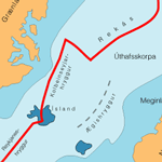 ◊
◊  ◊
◊  ◊
◊ 
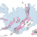
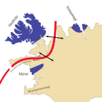
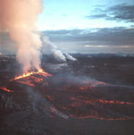
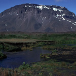
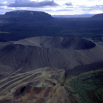
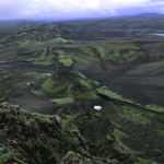
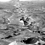
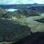
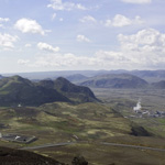
The volcanism today is only inside the active zones going across the island from south west to north east and because of the drifting and tectonic forces it is mostly inside fissure swarms formations. ◊ 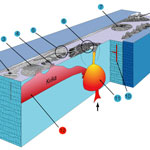 ◊ ◊
◊ ◊  ◊
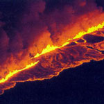
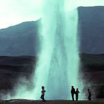
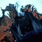
◊ 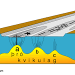 Them most typical eruptions for Iceland are effusive eruptions on fissures. ◊.
 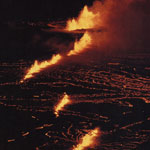 ◊
◊  ◊
◊ 
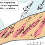
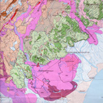
Stratigraphically Iceland is divided into four main divisions: The Tertiary Basalt formation (TBF), the Upper Pliocene and Lower Pleistocene Grey Basalt Formation (PPF), the Upper Pleistocene Móberg (Palagonite/Hyaloclastite) Formation (UPF) and Holocene lavas and sediments. ◊ 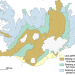 ◊
◊ 
The TBF/PPF boundaries follow Gauss/Gilbert (3,3 My) magnetic boundaries and the PPF/UPF boundaries follow Matuyama/Brunhes (0,8 My) magnetic boundaries. ◊ 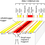
The TBF and the lower part of PPF is formed during eruptions and in absence of glaciers while the upper part of PPF and UPF is formed during sub glacial and interglacial eruptions. ◊ 
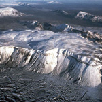
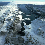
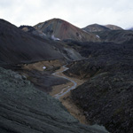
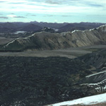
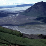
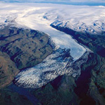
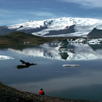
The glacial erosion has marked the TBF with fjords ◊ 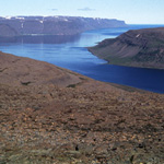 and valleys ◊
 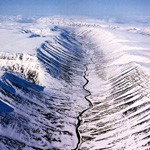 as the UPF has got its unique landscape from sub glacial volcanism. ◊.
 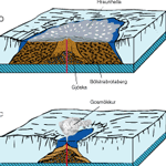 ◊
◊  ◊
◊  ◊
◊  ◊
◊  ◊
◊  ◊
◊  ◊
◊  ◊
◊  ◊
◊  ◊
◊ 
The Icelandic bedrocks are basalt lavas ≈ 80 - 85% mainly erupted in fissure eruptions, ◊ 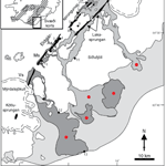 ◊
◊  ◊
◊  ◊.
◊.  andesite and rhyolithic ≈ 8% - 11% erupted in central volcanoes ◊
 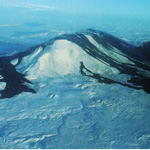 ◊
◊  ◊
◊  ◊
◊  ◊
◊  ◊
◊  and sediments ≈ 6%.
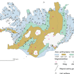
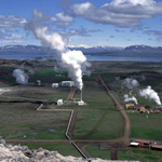
Geothermal heat ◊ 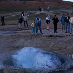 ◊
◊  is where ground water ◊
 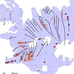 goes deep enough to reach hot intrution to be heated up. ◊
 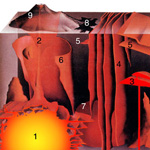 ◊
◊ 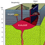 The areas with geothermal heat are spread over the island ◊
 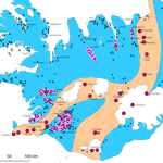 but those giving the most amount of energy are situated along the active zone "low heat areas" (below 150°C) ◊
 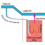 ◊
◊  ◊ and the "high temperature" areas (above 200°C) at central volcanoes inside the active zone. ◊
 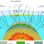 ◊
◊
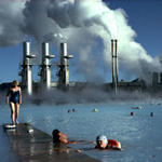
The hot water from the “low temperature” areas is used directly for heating and washing ◊ 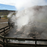 ◊
◊ 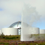 ◊.
◊.  but at the “high temperature” areas heat exchangers have to be used for warming up cold ground water by the steam and it is also used to produce electricity. ◊
  ◊
◊  ◊
◊  ◊
◊  ◊
◊  ◊
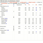
◊  See a |TABLE| with the main Geothermal Powerplants.
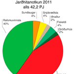
About 27.32% ◊ 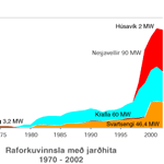 of the electric power production in Iceland came from geothermal energy the year 2011 and 87% of the inhabitants use geothermal energy to heat up their houses. ◊
 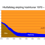 2011 ◊
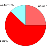
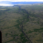
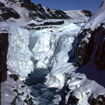
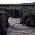
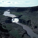
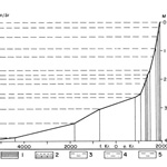
Icelandic rivers ◊ 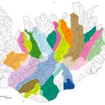 can be divided into three categories: Direct run of water, spring water and glacier rivers. ◊.
 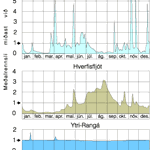 ◊
◊  ◊
◊  ◊
◊  ◊
◊  ◊
◊  ◊
◊  The greatest powerplants ◊
 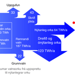 ◊
◊  have been built at the glacier rivers but great reservoirs are needed to collect the melting water at summer time and store it to the winter time. ◊
  ◊.
◊.  The greatest part of the electric energy goes to the aluminium industry. ◊
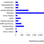
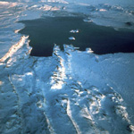
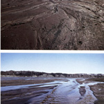
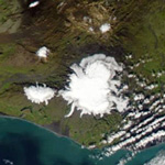
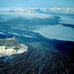
The frost and chemical weatering is fast and the main erotion factors are glaciers, ◊ 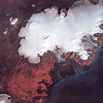 ◊
◊  ◊
◊  ◊
◊  ◊.
◊.  rivers, ◊
 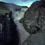 ◊
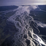
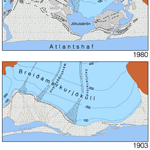
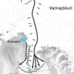
◊  and especially “jökulhlaup
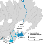 ” (subglacial floods) ◊
  ◊
◊  ◊
◊  ◊
◊ 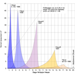 wind and ◊
 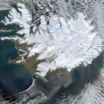 ocean waves at the coast.
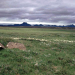
Vegitation ◊ 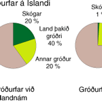 ◊
◊  and climate changes. ◊
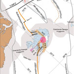
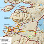
Straumsvík: ◊  Vatnsflæðikort af Reykjanesi: ◊
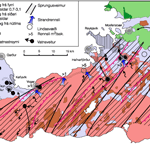
Efnainnihald vatns: |98|
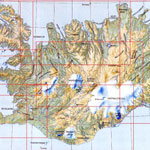
Map of Iceland ◊